 vesseltracker.com
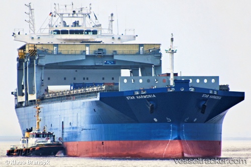
Vessel Star Harmonia IMO: 9103130, MMSI: 259885000 Multi Purpose Carrier
UTC, 29.43461, -66.09774, course: 70, speed: 12.4
UTC, 29.53845, -65.74706, course: 71, speed: 11.7
2026-01-19 17:31:16 UTC, 29.56474, -65.66235, course: 71, speed: 11.6
Live AIS position:
UTC. 167 nm S of Southampton),
updated 2026-01-19 17:31:16 UTC.
Find the position of the vessel Star Harmonia on the map. The latter are known coordinates and path.
marine traffic ship tracker show on live map
The current position of vessel Star Harmonia is 29.56474 lat / -65.66235 lng. Updated: 2026-01-19 17:31:16 UTCCurrently sailing under the flag of Norway
Star Harmonia built in 1998 year
Deadweight:
46604 tDetails:
Last coordinates of the vessel:
UTC, 29.41946, -66.14309, course: 70, speed: 12.5UTC, 29.43461, -66.09774, course: 70, speed: 12.4
UTC, 29.53845, -65.74706, course: 71, speed: 11.7
2026-01-19 17:31:16 UTC, 29.56474, -65.66235, course: 71, speed: 11.6