 vesseltracker.com
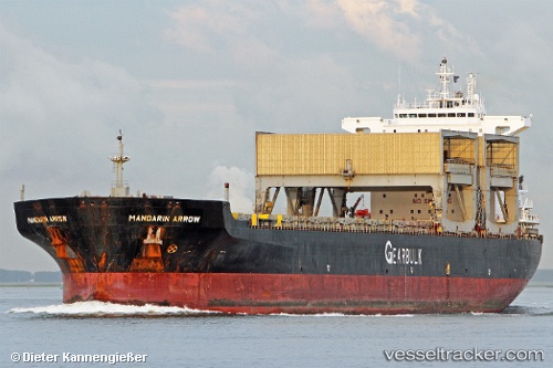
Vessel Mandarin Arrow IMO: 9105035, MMSI: 309601000 Multi Purpose Carrier
UTC, 35.03481, 136.84486, course: 341, speed: 0
UTC, 35.03482, 136.84486, course: 341, speed: 0
2026-02-09 16:16:36 UTC, 35.03482, 136.84486, course: 341, speed: 0
Live AIS position:
UTC. Near Nagoya),
updated 2026-02-09 16:16:36 UTC.
Find the position of the vessel Mandarin Arrow on the map. The latter are known coordinates and path.
marine traffic ship tracker show on live map
The current position of vessel Mandarin Arrow is 35.03482 lat / 136.84486 lng. Updated: 2026-02-09 16:16:36 UTCDetails:
Last coordinates of the vessel:
UTC, 35.03482, 136.84488, course: 341, speed: 0UTC, 35.03481, 136.84486, course: 341, speed: 0
UTC, 35.03482, 136.84486, course: 341, speed: 0
2026-02-09 16:16:36 UTC, 35.03482, 136.84486, course: 341, speed: 0