 vesseltracker.com
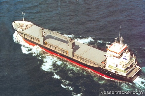
Vessel Pera IMO: 9111149, MMSI: 304010708 Multi Purpose Carrier
UTC, 11.70537, -73.56831, course: 244, speed: 9.8
UTC, 11.58323, -73.83335, course: 247, speed: 10.1
2026-02-06 07:26:19 UTC, 11.49186, -74.05340, course: 246, speed: 9.4
Live AIS position:
UTC. 17 nm NE of Santa Marta),
updated 2026-02-06 07:26:19 UTC.
Find the position of the vessel Pera on the map. The latter are known coordinates and path.
marine traffic ship tracker show on live map
The current position of vessel Pera is 11.49186 lat / -74.05340 lng. Updated: 2026-02-06 07:26:19 UTCCurrently sailing under the flag of Antigua Barbuda
Pera built in 1995 year
Deadweight:
3600 tDetails:
Last coordinates of the vessel:
UTC, 11.70537, -73.56831, course: 244, speed: 9.8UTC, 11.70537, -73.56831, course: 244, speed: 9.8
UTC, 11.58323, -73.83335, course: 247, speed: 10.1
2026-02-06 07:26:19 UTC, 11.49186, -74.05340, course: 246, speed: 9.4