 vesseltracker.com
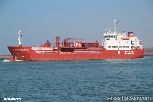
Vessel B Gas Commander IMO: 9112155, MMSI: 256792000 Lpg Tanker
UTC, 32.13167, 119.90500, course: -1, speed: 0
UTC, 32.13167, 119.90500, course: -1, speed: 0
2026-02-21 17:48:55 UTC, 32.13314, 119.90629, course: 341, speed: 0
Live AIS position:
UTC. Near Taixing),
updated 2026-02-21 17:48:55 UTC.
Find the position of the vessel B Gas Commander on the map. The latter are known coordinates and path.
marine traffic ship tracker show on live map
The current position of vessel B Gas Commander is 32.13314 lat / 119.90629 lng. Updated: 2026-02-21 17:48:55 UTCCurrently sailing under the flag of Malta
B Gas Commander built in 1996 year
Deadweight:
2335 tDetails:
Last coordinates of the vessel:
UTC, 32.13746, 119.90545, course: 158, speed: 0UTC, 32.13167, 119.90500, course: -1, speed: 0
UTC, 32.13167, 119.90500, course: -1, speed: 0
2026-02-21 17:48:55 UTC, 32.13314, 119.90629, course: 341, speed: 0