 vesseltracker.com
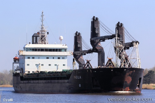
Vessel Pasila IMO: 9113018, MMSI: 230336000 General Cargo Ship
UTC, 61.60033, 21.47293, course: 128, speed: 0
UTC, 61.60033, 21.47293, course: 128, speed: 0
2026-01-30 03:32:53 UTC, 61.60033, 21.47292, course: 128, speed: 0
Live AIS position:
UTC. Near Reposaari),
updated 2026-01-30 03:32:53 UTC.
Find the position of the vessel Pasila on the map. The latter are known coordinates and path.
marine traffic ship tracker show on live map
The current position of vessel Pasila is 61.60033 lat / 21.47292 lng. Updated: 2026-01-30 03:32:53 UTCCurrently sailing under the flag of Finland
Pasila built in 1995 year
Deadweight:
13367 tDetails:
Last coordinates of the vessel:
UTC, 61.60033, 21.47292, course: 128, speed: 0.1UTC, 61.60033, 21.47293, course: 128, speed: 0
UTC, 61.60033, 21.47293, course: 128, speed: 0
2026-01-30 03:32:53 UTC, 61.60033, 21.47292, course: 128, speed: 0