 vesseltracker.com
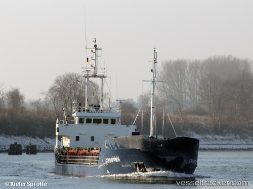
Vessel LOGIMAR II IMO: 9116773, MMSI: 725003217 General Cargo Ship
UTC, -49.82167, -74.37333, course: -1, speed: 9
UTC, -50.06833, -74.60333, course: -1, speed: 9
2026-02-27 22:10:21 UTC, -50.43351, -74.86928, course: 195, speed: 8.3
Live AIS position:
UTC. 77 nm NW of Torres del Paine),
updated 2026-02-27 22:10:21 UTC.
Find the position of the vessel LOGIMAR II on the map. The latter are known coordinates and path.
marine traffic ship tracker show on live map
The current position of vessel LOGIMAR II is -50.43351 lat / -74.86928 lng. Updated: 2026-02-27 22:10:21 UTCCurrently sailing under the flag of Chile
LOGIMAR II built in 1994 year
Deadweight:
2300 tDetails:
Last coordinates of the vessel:
UTC, -49.55673, -74.45971, course: 173, speed: 8.5UTC, -49.82167, -74.37333, course: -1, speed: 9
UTC, -50.06833, -74.60333, course: -1, speed: 9
2026-02-27 22:10:21 UTC, -50.43351, -74.86928, course: 195, speed: 8.3