 vesseltracker.com
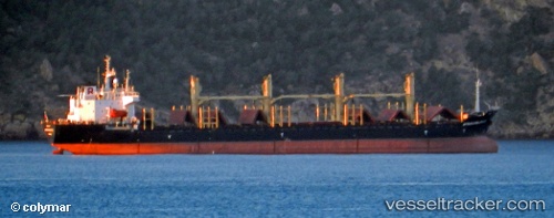
Vessel Prince Farouk IMO: 9125229, MMSI: 667001699 Bulk Carrier
UTC, 40.46411, 26.78028, course: -1, speed: 0
UTC, 40.28697, 26.54807, course: -1, speed: 12.1
2026-02-22 09:38:49 UTC, 40.11916, 26.35920, course: -1, speed: 12.4
Live AIS position:
UTC. Near Akcansa),
updated 2026-02-22 09:38:49 UTC.
Find the position of the vessel Prince Farouk on the map. The latter are known coordinates and path.
marine traffic ship tracker show on live map
The current position of vessel Prince Farouk is 40.11916 lat / 26.35920 lng. Updated: 2026-02-22 09:38:49 UTCCurrently sailing under the flag of Sierra Leone
Prince Farouk built in 1997 year
Deadweight:
26412 tDetails:
Last coordinates of the vessel:
UTC, 40.46408, 26.78022, course: -1, speed: 0UTC, 40.46411, 26.78028, course: -1, speed: 0
UTC, 40.28697, 26.54807, course: -1, speed: 12.1
2026-02-22 09:38:49 UTC, 40.11916, 26.35920, course: -1, speed: 12.4