 vesseltracker.com
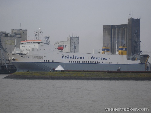
Vessel JABAL ALI 11 IMO: 9125372, MMSI: 341743001 Ro-Ro Cargo
UTC, 24.99415, 55.08056, course: -1, speed: 0.8
UTC, 24.99425, 55.08072, course: 225, speed: 0
2026-03-01 10:17:48 UTC, 24.99375, 55.08089, course: 225, speed: 14.6
Live AIS position:
UTC. Near Jebel Ali Free Zone),
updated 2026-03-01 10:17:48 UTC.
Find the position of the vessel JABAL ALI 11 on the map. The latter are known coordinates and path.
marine traffic ship tracker show on live map
The current position of vessel JABAL ALI 11 is 24.99375 lat / 55.08089 lng. Updated: 2026-03-01 10:17:48 UTCCurrently sailing under the flag of Saint Kitts and Nevis
Details:
Last coordinates of the vessel:
UTC, 24.99424, 55.08086, course: -1, speed: 0.4UTC, 24.99415, 55.08056, course: -1, speed: 0.8
UTC, 24.99425, 55.08072, course: 225, speed: 0
2026-03-01 10:17:48 UTC, 24.99375, 55.08089, course: 225, speed: 14.6