 vesseltracker.com
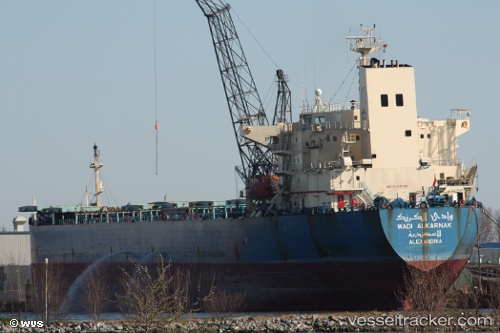
Vessel Wadi Al Karnak IMO: 9127136, MMSI: 622121425 Bulk Carrier
UTC, 43.22735, 34.22340, course: 58, speed: 10.9
UTC, 43.32561, 34.49799, course: 57, speed: 11.2
2026-01-19 02:29:00 UTC, 43.32561, 34.49799, course: 57, speed: 11.2
Live AIS position:
UTC. 71 nm S of Yalta),
updated 2026-01-19 02:29:00 UTC.
Find the position of the vessel Wadi Al Karnak on the map. The latter are known coordinates and path.
marine traffic ship tracker show on live map
The current position of vessel Wadi Al Karnak is 43.32561 lat / 34.49799 lng. Updated: 2026-01-19 02:29:00 UTCCurrently sailing under the flag of Egypt
Wadi Al Karnak built in 1997 year
Deadweight:
64214 tDetails:
Last coordinates of the vessel:
UTC, 43.22735, 34.22340, course: 58, speed: 10.9UTC, 43.22735, 34.22340, course: 58, speed: 10.9
UTC, 43.32561, 34.49799, course: 57, speed: 11.2
2026-01-19 02:29:00 UTC, 43.32561, 34.49799, course: 57, speed: 11.2