 vesseltracker.com
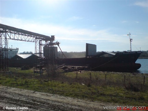
Vessel Nardis IMO: 9137246, MMSI: 422914000 Multi Purpose Carrier
UTC, 43.04445, 47.60686, course: 19, speed: 0.5
UTC, 43.04445, 47.60686, course: 19, speed: 0.5
2026-03-09 13:03:59 UTC, 43.04445, 47.60686, course: 19, speed: 0.5
Live Vessel Nardis Analytics (details, animations, etc.)
Live AIS position: UTC. Near Makhachkala), updated 2026-03-09 13:03:59 UTC.Find the position of the vessel Nardis on the map. The latter are known coordinates and path.
marine traffic ship tracker show on live map
The current position of vessel Nardis is 43.04445 lat / 47.60686 lng. Updated: 2026-03-09 13:03:59 UTCDetails:
Last coordinates of the vessel:
UTC, 36.98216, 53.37819, course: 357, speed: 5.4UTC, 43.04445, 47.60686, course: 19, speed: 0.5
UTC, 43.04445, 47.60686, course: 19, speed: 0.5
2026-03-09 13:03:59 UTC, 43.04445, 47.60686, course: 19, speed: 0.5