 vesseltracker.com
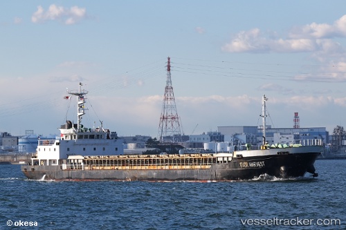
Vessel Ever Harvest IMO: 9140504, MMSI: 511294000 General Cargo Ship
UTC, 37.61167, 141.10834, course: -1, speed: 10
UTC, 37.28664, 141.10139, course: 191, speed: 9.3
2026-02-12 06:20:17 UTC, 36.99628, 141.08998, course: 185, speed: 9.4
Live AIS position:
UTC. 11 nm NE of ONAHAMA),
updated 2026-02-12 06:20:17 UTC.
Find the position of the vessel Ever Harvest on the map. The latter are known coordinates and path.
marine traffic ship tracker show on live map
The current position of vessel Ever Harvest is 36.99628 lat / 141.08998 lng. Updated: 2026-02-12 06:20:17 UTCCurrently sailing under the flag of Palau
Details:
Last coordinates of the vessel:
UTC, 37.83500, 140.95833, course: -1, speed: 0UTC, 37.61167, 141.10834, course: -1, speed: 10
UTC, 37.28664, 141.10139, course: 191, speed: 9.3
2026-02-12 06:20:17 UTC, 36.99628, 141.08998, course: 185, speed: 9.4