 vesseltracker.com
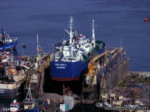
Vessel Santa Maria Ii IMO: 9141584, MMSI: 725000219 Fishing Vessel
UTC, -41.51750, -73.01117, course: 309, speed: 0.1
UTC, -41.51755, -73.01113, course: 308, speed: 0
2026-03-20 16:12:51 UTC, -41.51694, -73.01117, course: 221, speed: 0.1
Live Vessel Santa Maria Ii Analytics (details, animations, etc.)
Live AIS position: UTC. Near Puerto Montt), updated 2026-03-20 16:12:51 UTC.Find the position of the vessel Santa Maria Ii on the map. The latter are known coordinates and path.
marine traffic ship tracker show on live map
The current position of vessel Santa Maria Ii is -41.51694 lat / -73.01117 lng. Updated: 2026-03-20 16:12:51 UTCDetails:
Last coordinates of the vessel:
UTC, -41.51768, -73.01129, course: -1, speed: 0.1UTC, -41.51750, -73.01117, course: 309, speed: 0.1
UTC, -41.51755, -73.01113, course: 308, speed: 0
2026-03-20 16:12:51 UTC, -41.51694, -73.01117, course: 221, speed: 0.1