 vesseltracker.com
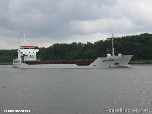
Vessel Johanne IMO: 9143269, MMSI: 305627000 Multi Purpose Carrier
UTC, -22.23833, 62.00833, course: -1, speed: 15
UTC, -22.39220, 61.59548, course: 249, speed: 15.2
2026-02-26 11:17:56 UTC, -22.50980, 61.23090, course: 253, speed: 14.7
Live AIS position:
UTC. 163 nm NE of Al Azaiba),
updated 2026-02-26 11:17:56 UTC.
Find the position of the vessel Johanne on the map. The latter are known coordinates and path.
marine traffic ship tracker show on live map
The current position of vessel Johanne is -22.50980 lat / 61.23090 lng. Updated: 2026-02-26 11:17:56 UTCDetails:
Last coordinates of the vessel:
UTC, -22.02503, 62.63518, course: 251, speed: 15.1UTC, -22.23833, 62.00833, course: -1, speed: 15
UTC, -22.39220, 61.59548, course: 249, speed: 15.2
2026-02-26 11:17:56 UTC, -22.50980, 61.23090, course: 253, speed: 14.7