 vesseltracker.com
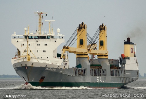
Vessel Annegret IMO: 9147710, MMSI: 304081024 Heavy Load Carrier
UTC, 20.39061, 174.27299, course: 280, speed: 16.8
UTC, 20.45297, 173.73322, course: 280, speed: 17.3
2026-02-25 14:08:38 UTC, 20.52399, 173.14690, course: 280, speed: 16.9
Live AIS position:
UTC. 378 nm E of Wake Island),
updated 2026-02-25 14:08:38 UTC.
Find the position of the vessel Annegret on the map. The latter are known coordinates and path.
marine traffic ship tracker show on live map
The current position of vessel Annegret is 20.52399 lat / 173.14690 lng. Updated: 2026-02-25 14:08:38 UTCCurrently sailing under the flag of Antigua Barbuda
Annegret built in 2000 year
Deadweight:
9359 tDetails:
Last coordinates of the vessel:
UTC, 20.28063, 175.15443, course: 280, speed: 17.2UTC, 20.39061, 174.27299, course: 280, speed: 16.8
UTC, 20.45297, 173.73322, course: 280, speed: 17.3
2026-02-25 14:08:38 UTC, 20.52399, 173.14690, course: 280, speed: 16.9