 vesseltracker.com
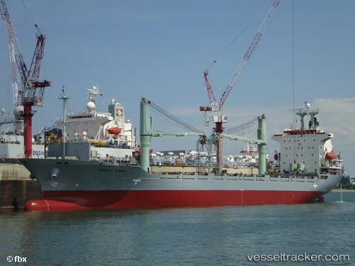
Vessel Meratus Manado IMO: 9154830, MMSI: 525025049 Container Ship
UTC, -6.85381, 112.86405, course: -1, speed: 0.6
UTC, -6.85434, 112.86422, course: -1, speed: 0.3
2026-02-22 12:00:25 UTC, -6.85490, 112.86431, course: -1, speed: 0.2
Live AIS position:
UTC. Near Madura Terminal),
updated 2026-02-22 12:00:25 UTC.
Find the position of the vessel Meratus Manado on the map. The latter are known coordinates and path.
marine traffic ship tracker show on live map
The current position of vessel Meratus Manado is -6.85490 lat / 112.86431 lng. Updated: 2026-02-22 12:00:25 UTCDetails:
Last coordinates of the vessel:
UTC, -6.85524, 112.86423, course: -1, speed: 0.2UTC, -6.85381, 112.86405, course: -1, speed: 0.6
UTC, -6.85434, 112.86422, course: -1, speed: 0.3
2026-02-22 12:00:25 UTC, -6.85490, 112.86431, course: -1, speed: 0.2