 vesseltracker.com
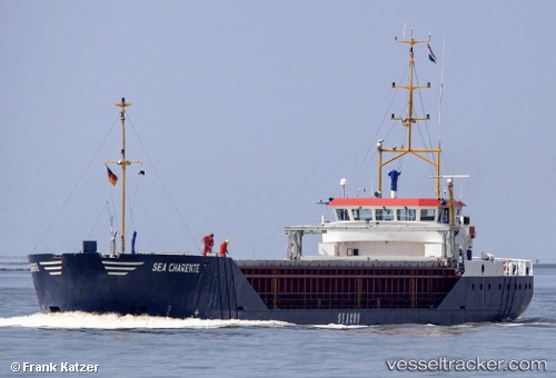
Vessel Sea Charente IMO: 9155676, MMSI: 246362000 General Cargo Ship
UTC, 50.54598, -3.50356, course: 97, speed: 0
UTC, 50.54597, -3.50358, course: 97, speed: 0.1
2026-02-05 08:15:58 UTC, 50.54597, -3.50357, course: 97, speed: 0
Live AIS position:
UTC. Near TEIGNMOUTH),
updated 2026-02-05 08:15:58 UTC.
Find the position of the vessel Sea Charente on the map. The latter are known coordinates and path.
marine traffic ship tracker show on live map
The current position of vessel Sea Charente is 50.54597 lat / -3.50357 lng. Updated: 2026-02-05 08:15:58 UTCCurrently sailing under the flag of Netherlands
Sea Charente built in 1996 year
Deadweight:
2100 tDetails:
Last coordinates of the vessel:
UTC, 50.54599, -3.50357, course: 97, speed: 0UTC, 50.54598, -3.50356, course: 97, speed: 0
UTC, 50.54597, -3.50358, course: 97, speed: 0.1
2026-02-05 08:15:58 UTC, 50.54597, -3.50357, course: 97, speed: 0