 vesseltracker.com
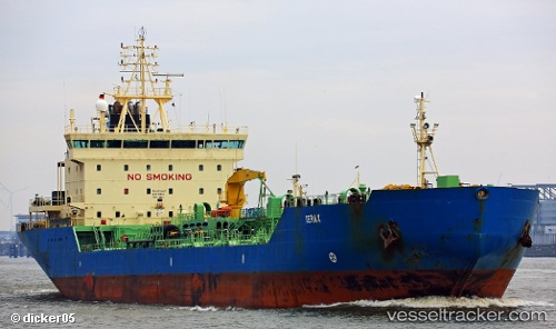
Vessel YUANDONG IMO: 9156498, MMSI: 352001664 Chemical/Oil Products Tanker
UTC, 23.47023, 64.02376, course: 106, speed: 0
UTC, 23.47023, 64.02376, course: 106, speed: 0
2026-01-31 04:30:23 UTC, 23.47023, 64.02376, course: 106, speed: 0
Live AIS position:
UTC. 180 nm SW of Kiamari),
updated 2026-01-31 04:30:23 UTC.
Find the position of the vessel YUANDONG on the map. The latter are known coordinates and path.
marine traffic ship tracker show on live map
The current position of vessel YUANDONG is 23.47023 lat / 64.02376 lng. Updated: 2026-01-31 04:30:23 UTCCurrently sailing under the flag of Panama
YUANDONG built in 1998 year
Deadweight:
15885 tDetails:
Last coordinates of the vessel:
UTC, 23.47026, 64.02391, course: 106, speed: 0UTC, 23.47023, 64.02376, course: 106, speed: 0
UTC, 23.47023, 64.02376, course: 106, speed: 0
2026-01-31 04:30:23 UTC, 23.47023, 64.02376, course: 106, speed: 0