 vesseltracker.com
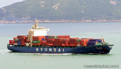
Vessel Bridge IMO: 9158587, MMSI: 353851000 Container Ship
UTC, 4.16975, 104.19873, course: 162, speed: 19.2
UTC, 3.54688, 104.38607, course: 163, speed: 19.2
2026-02-14 02:10:36 UTC, 2.73628, 104.62905, course: 164, speed: 19.6
Live AIS position:
UTC. 63 nm E of Kampung Jawa),
updated 2026-02-14 02:10:36 UTC.
Find the position of the vessel Bridge on the map. The latter are known coordinates and path.
marine traffic ship tracker show on live map
The current position of vessel Bridge is 2.73628 lat / 104.62905 lng. Updated: 2026-02-14 02:10:36 UTCDetails:
Last coordinates of the vessel:
UTC, 4.74212, 104.02461, course: 163, speed: 19.3UTC, 4.16975, 104.19873, course: 162, speed: 19.2
UTC, 3.54688, 104.38607, course: 163, speed: 19.2
2026-02-14 02:10:36 UTC, 2.73628, 104.62905, course: 164, speed: 19.6