 vesseltracker.com
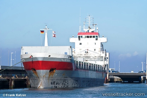
Vessel Vlistborg IMO: 9160346, MMSI: 244850612 General Cargo Ship
UTC, 49.94579, -2.19934, course: 74, speed: 9
UTC, 50.01786, -1.76822, course: 76, speed: 8.9
2026-02-27 11:24:49 UTC, 50.05445, -1.55088, course: 77, speed: 9.6
Live AIS position:
UTC. 23 nm N of Fermanville),
updated 2026-02-27 11:24:49 UTC.
Find the position of the vessel Vlistborg on the map. The latter are known coordinates and path.
marine traffic ship tracker show on live map
The current position of vessel Vlistborg is 50.05445 lat / -1.55088 lng. Updated: 2026-02-27 11:24:49 UTCCurrently sailing under the flag of Netherlands
Vlistborg built in 1999 year
Deadweight:
8664 tDetails:
Last coordinates of the vessel:
UTC, 49.85376, -2.69643, course: 73, speed: 10.2UTC, 49.94579, -2.19934, course: 74, speed: 9
UTC, 50.01786, -1.76822, course: 76, speed: 8.9
2026-02-27 11:24:49 UTC, 50.05445, -1.55088, course: 77, speed: 9.6