 vesseltracker.com
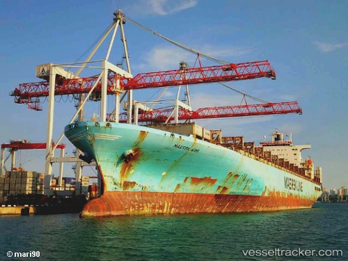
Vessel MAERSK KIMI IMO: 9162227, MMSI: 636020349 Container Ship
UTC, -23.98833, -44.35500, course: -1, speed: 17
UTC, -24.04930, -44.59469, course: 256, speed: 17.9
2026-02-21 08:14:18 UTC, -24.28898, -45.48030, course: 260, speed: 17.3
Live AIS position:
UTC. 30 nm S of Sao Sebastiao),
updated 2026-02-21 08:14:18 UTC.
Find the position of the vessel MAERSK KIMI on the map. The latter are known coordinates and path.
marine traffic ship tracker show on live map
The current position of vessel MAERSK KIMI is -24.28898 lat / -45.48030 lng. Updated: 2026-02-21 08:14:18 UTCCurrently sailing under the flag of Liberia
MAERSK KIMI built in 1998 year
Deadweight:
94769 tDetails:
Last coordinates of the vessel:
UTC, -23.74167, -43.45667, course: -1, speed: 18UTC, -23.98833, -44.35500, course: -1, speed: 17
UTC, -24.04930, -44.59469, course: 256, speed: 17.9
2026-02-21 08:14:18 UTC, -24.28898, -45.48030, course: 260, speed: 17.3