 vesseltracker.com
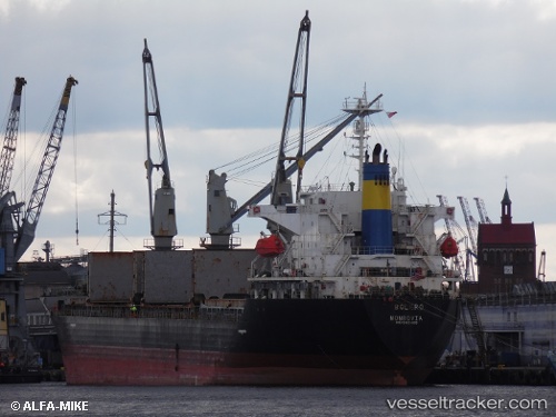
Vessel VAFAA M IMO: 9162409, MMSI: 518101010 General Cargo Ship
Live AIS position:
UTC. 20 nm NW of Baba Point),
updated 2024-09-18 11:15:19 UTC.
Find the position of the vessel VAFAA M on the map. The latter are known coordinates and path.
marine traffic ship tracker show on live map
The current position of vessel VAFAA M is 39.60090 lat / 25.67891 lng. Updated: 2024-09-18 11:15:19 UTCCurrently sailing under the flag of Cook islands
VAFAA M built in 1997 year
Deadweight:
25008 tDetails:
Last coordinates of the vessel:
2024-09-18 11:15:19 UTC, 39.60090, 25.67891, course: -1, speed: 10.8