 vesseltracker.com
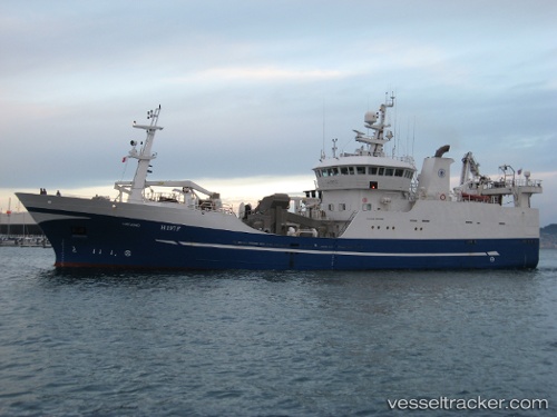
Vessel Viking IMO: 9167916, MMSI: 273411340 Fishing Vessel
UTC, 56.28833, 145.42500, course: -1, speed: 1
UTC, 56.32262, 145.40950, course: 263, speed: 1
2026-02-21 01:59:00 UTC, 56.34833, 145.41499, course: -1, speed: 0
Live AIS position:
UTC. 185 nm NE of Okha),
updated 2026-02-21 01:59:00 UTC.
Find the position of the vessel Viking on the map. The latter are known coordinates and path.
marine traffic ship tracker show on live map
The current position of vessel Viking is 56.34833 lat / 145.41499 lng. Updated: 2026-02-21 01:59:00 UTCDetails:
Last coordinates of the vessel:
UTC, 56.25833, 145.46667, course: -1, speed: 0UTC, 56.28833, 145.42500, course: -1, speed: 1
UTC, 56.32262, 145.40950, course: 263, speed: 1
2026-02-21 01:59:00 UTC, 56.34833, 145.41499, course: -1, speed: 0