 vesseltracker.com
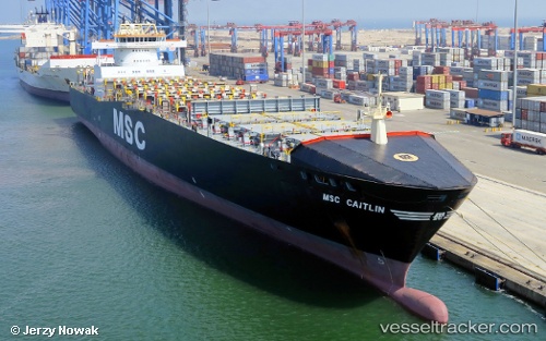
Vessel Msc Caitlin IMO: 9169043, MMSI: 636018323 Container Ship
UTC, 32.81625, 32.75594, course: 207, speed: 13.1
UTC, 32.29987, 32.37659, course: 218, speed: 13.3
2026-02-08 05:43:51 UTC, 32.01596, 32.15747, course: 210, speed: 12.8
Live AIS position:
UTC. 27 nm NE of Bnei Darom),
updated 2026-02-08 05:43:51 UTC.
Find the position of the vessel Msc Caitlin on the map. The latter are known coordinates and path.
marine traffic ship tracker show on live map
The current position of vessel Msc Caitlin is 32.01596 lat / 32.15747 lng. Updated: 2026-02-08 05:43:51 UTCCurrently sailing under the flag of Liberia
Msc Caitlin built in 1998 year
Deadweight:
18779 tDetails:
Last coordinates of the vessel:
UTC, 33.04013, 32.92575, course: 214, speed: 12.9UTC, 32.81625, 32.75594, course: 207, speed: 13.1
UTC, 32.29987, 32.37659, course: 218, speed: 13.3
2026-02-08 05:43:51 UTC, 32.01596, 32.15747, course: 210, speed: 12.8