 vesseltracker.com
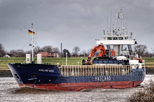
Vessel Hagland Boss IMO: 9171058, MMSI: 249934000 Multi Purpose Carrier
UTC, 54.60507, 18.90903, course: 22, speed: 9.6
UTC, 54.91505, 18.62430, course: 307, speed: 9.4
2026-02-19 11:29:29 UTC, 54.93311, 18.26013, course: 272, speed: 9.5
Live AIS position:
UTC. Near Krokowa),
updated 2026-02-19 11:29:29 UTC.
Find the position of the vessel Hagland Boss on the map. The latter are known coordinates and path.
marine traffic ship tracker show on live map
The current position of vessel Hagland Boss is 54.93311 lat / 18.26013 lng. Updated: 2026-02-19 11:29:29 UTCCurrently sailing under the flag of Malta
Hagland Boss built in 1997 year
Deadweight:
3694 tDetails:
Last coordinates of the vessel:
UTC, 54.52329, 18.55989, course: 176, speed: 0UTC, 54.60507, 18.90903, course: 22, speed: 9.6
UTC, 54.91505, 18.62430, course: 307, speed: 9.4
2026-02-19 11:29:29 UTC, 54.93311, 18.26013, course: 272, speed: 9.5