 vesseltracker.com
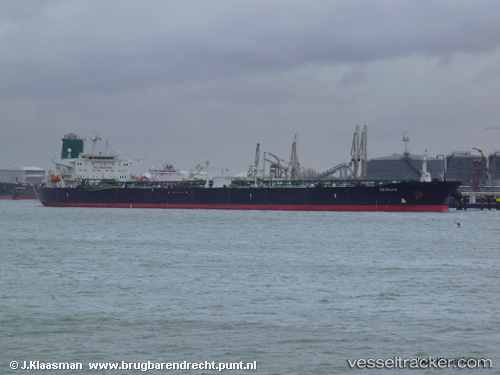
Vessel Stark I IMO: 9171450, MMSI: 422172000 Crude Oil Tanker
UTC, 26.26053, 56.70329, course: 11, speed: 10.3
UTC, 26.26053, 56.70329, course: 11, speed: 10.3
2026-02-05 06:56:45 UTC, 26.26053, 56.70329, course: 11, speed: 10.3
Live AIS position:
UTC. 21 nm E of HASSA),
updated 2026-02-05 06:56:45 UTC.
Find the position of the vessel Stark I on the map. The latter are known coordinates and path.
marine traffic ship tracker show on live map
The current position of vessel Stark I is 26.26053 lat / 56.70329 lng. Updated: 2026-02-05 06:56:45 UTCDetails:
Last coordinates of the vessel:
UTC, 25.51648, 56.74795, course: 354, speed: 9.7UTC, 26.26053, 56.70329, course: 11, speed: 10.3
UTC, 26.26053, 56.70329, course: 11, speed: 10.3
2026-02-05 06:56:45 UTC, 26.26053, 56.70329, course: 11, speed: 10.3