 vesseltracker.com
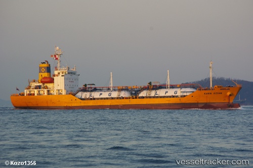
Vessel MAYA GAS 1 IMO: 9172753, MMSI: 620999533 Tanker
UTC, 25.29760, 57.07661, course: 244, speed: 0.8
UTC, 25.27556, 57.08431, course: -1, speed: 0
2026-03-06 14:02:45 UTC, 25.32660, 57.07066, course: 220, speed: 45.3
Live Vessel MAYA GAS 1 Analytics (details, animations, etc.)
Live AIS position: UTC. 22 nm E of Offshore Fujairah), updated 2026-03-06 14:02:45 UTC.Find the position of the vessel MAYA GAS 1 on the map. The latter are known coordinates and path.
marine traffic ship tracker show on live map
The current position of vessel MAYA GAS 1 is 25.32660 lat / 57.07066 lng. Updated: 2026-03-06 14:02:45 UTCCurrently sailing under the flag of Comoros
Details:
Last coordinates of the vessel:
UTC, 25.31927, 57.06341, course: -1, speed: 0.6UTC, 25.29760, 57.07661, course: 244, speed: 0.8
UTC, 25.27556, 57.08431, course: -1, speed: 0
2026-03-06 14:02:45 UTC, 25.32660, 57.07066, course: 220, speed: 45.3