 vesseltracker.com
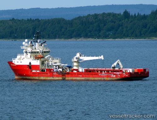
Vessel Northern River IMO: 9179323, MMSI: 235090402 Offshore Tug Supply Ship
UTC, 36.17632, -4.43778, course: 260, speed: 4.7
UTC, 36.16050, -4.57171, course: 258, speed: 4.6
2026-02-13 06:09:23 UTC, 36.14049, -4.78781, course: 264, speed: 4.3
Live AIS position:
UTC. 23 nm S of Nueva Andalucia),
updated 2026-02-13 06:09:23 UTC.
Find the position of the vessel Northern River on the map. The latter are known coordinates and path.
marine traffic ship tracker show on live map
The current position of vessel Northern River is 36.14049 lat / -4.78781 lng. Updated: 2026-02-13 06:09:23 UTCCurrently sailing under the flag of United Kingdom
Northern River built in 1998 year
Deadweight:
4550 tDetails:
Last coordinates of the vessel:
UTC, 36.21017, -4.12215, course: 273, speed: 5.5UTC, 36.17632, -4.43778, course: 260, speed: 4.7
UTC, 36.16050, -4.57171, course: 258, speed: 4.6
2026-02-13 06:09:23 UTC, 36.14049, -4.78781, course: 264, speed: 4.3