 vesseltracker.com
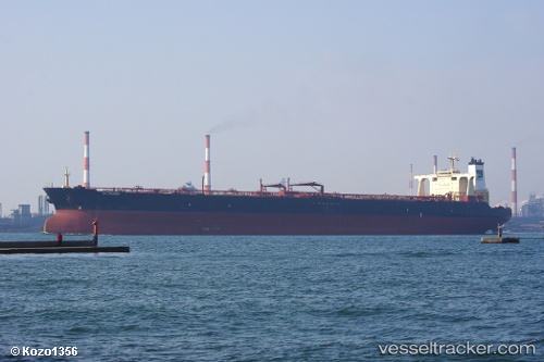
Vessel '567601000' IMO: 9180891, MMSI: 567601000
UTC, 1.22771, 103.55638, course: 102, speed: 0
UTC, 1.22870, 103.55680, course: 121, speed: 0
2026-01-27 08:05:03 UTC, 1.22834, 103.55667, course: 112, speed: 0
Live AIS position:
UTC. Near TANJUNG PELEPAS),
updated 2026-01-27 08:05:03 UTC.
Find the position of the vessel '567601000' on the map. The latter are known coordinates and path.
marine traffic ship tracker show on live map
The current position of vessel '567601000' is 1.22834 lat / 103.55667 lng. Updated: 2026-01-27 08:05:03 UTCDetails:
Last coordinates of the vessel:
UTC, 1.22761, 103.55666, course: 102, speed: 0.1UTC, 1.22771, 103.55638, course: 102, speed: 0
UTC, 1.22870, 103.55680, course: 121, speed: 0
2026-01-27 08:05:03 UTC, 1.22834, 103.55667, course: 112, speed: 0