.
vessel IONA IMO: 9183271, Crude Oil Tanker vesseltracker.com
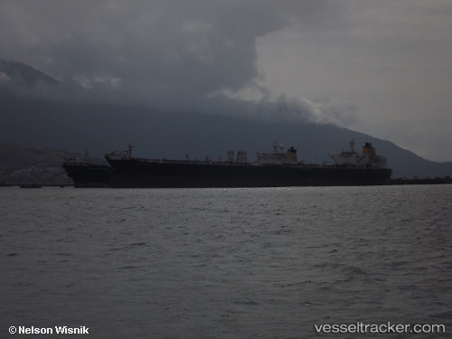
Vessel IONA IMO: 9183271, MMSI: 613003744 Crude Oil Tanker

callsign: TJMC144
size: 46x272

Live AIS position: UTC. 71 nm SW of Paphos), updated 2026-01-31 17:36:09 UTC.

Find the position of the vessel IONA on the map. The latter are known coordinates and path.

marine traffic ship tracker show on live map

The current position of vessel IONA is 33.69031 lat / 31.77178 lng. Updated: 2026-01-31 17:36:09 UTC

Currently sailing under the flag of Cameroon

IONA built in 2000 year

Deadweight:
153071 t

Details:


Last coordinates of the vessel:
UTC, 33.88833, 31.82333, course: -1, speed: 9
2026-01-31 17:36:09 UTC, 33.69031, 31.77178, course: -1, speed: 0.7


Most frequent ports a vessels calls at IONA (613003744):

Ruch’I, traffic: 3
Skagens Odde, traffic: 3
Primorsk, traffic: 2
Strait Of Gibraltar, traffic: 2
Ust-Luga, traffic: 2
Port Said, traffic: 1
Ra’S Shukhayr, traffic: 1
Sambu, traffic: 1
Singapore, traffic: 1
Algeciras, traffic: 1
Bur Ibrahim, traffic: 1
ZHOUSHAN, traffic: 1
Korsor, traffic: 1
SHUIDONG, traffic: 1

Link to the map:


Find another ship

IONA (613003744) last ports (portcalls and passsages)

ZHOUSHAN | 2025-08-11 13:05:21
SHUIDONG | 2024-11-18 11:17:49
Singapore | 2023-07-31 20:53:57
Ra’S Shukhayr | 2023-05-27 02:27:07
Bur Ibrahim | 2023-05-26 16:55:48
Port Said | 2023-05-26 08:07:49
Strait Of Gibraltar | 2023-05-19 07:39:53
Skagens Odde | 2023-05-13 01:53:41
Korsor | 2023-05-12 09:29:53
Ust-Luga | 2023-05-06 23:10:41
Ruch’I | 2023-05-06 21:14:46
Primorsk | 2023-05-04 10:14:32
Skagens Odde | 2023-04-24 05:24:16
Strait Of Gibraltar | 2023-02-25 00:11:33
Algeciras | 2023-02-19 20:01:49
Skagens Odde | 2023-01-28 00:07:53
Primorsk | 2023-01-21 23:09:41
Ruch’I | 2023-01-17 05:07:58
Ust-Luga | 2023-01-14 02:53:43
Ruch’I | 2023-01-13 02:55:02