 vesseltracker.com
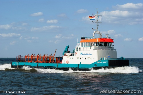
Vessel Coastal Liberty IMO: 9186077, MMSI: 246852000 Offshore Tug Supply Ship
UTC, 53.86926, 8.71054, course: 205, speed: 0
UTC, 53.86927, 8.71053, course: 205, speed: 0
2026-01-18 13:08:01 UTC, 53.86927, 8.71054, course: 206, speed: 0
Live AIS position:
UTC. Near Cuxhaven),
updated 2026-01-18 13:08:01 UTC.
Find the position of the vessel Coastal Liberty on the map. The latter are known coordinates and path.
marine traffic ship tracker show on live map
The current position of vessel Coastal Liberty is 53.86927 lat / 8.71054 lng. Updated: 2026-01-18 13:08:01 UTCCurrently sailing under the flag of Netherlands
Coastal Liberty built in 1997 year
Deadweight:
233 tDetails:
Last coordinates of the vessel:
UTC, 53.86930, 8.71055, course: 207, speed: 0UTC, 53.86926, 8.71054, course: 205, speed: 0
UTC, 53.86927, 8.71053, course: 205, speed: 0
2026-01-18 13:08:01 UTC, 53.86927, 8.71054, course: 206, speed: 0