 vesseltracker.com
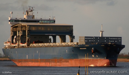
Vessel INDIANA IMO: 9186211, MMSI: 257548000 General Cargo Ship
UTC, -29.55214, 13.32984, course: 318, speed: 13.1
UTC, -29.12621, 12.97134, course: 318, speed: 13.1
2026-02-26 00:17:04 UTC, -28.76785, 12.63257, course: 319, speed: 13.5
Live AIS position:
UTC. 185 nm SW of Luderitz Bay),
updated 2026-02-26 00:17:04 UTC.
Find the position of the vessel INDIANA on the map. The latter are known coordinates and path.
marine traffic ship tracker show on live map
The current position of vessel INDIANA is -28.76785 lat / 12.63257 lng. Updated: 2026-02-26 00:17:04 UTCCurrently sailing under the flag of Norway (NIS)
INDIANA built in 2000 year
Deadweight:
44982 tDetails:
Last coordinates of the vessel:
UTC, -29.77819, 13.52792, course: 321, speed: 12.4UTC, -29.55214, 13.32984, course: 318, speed: 13.1
UTC, -29.12621, 12.97134, course: 318, speed: 13.1
2026-02-26 00:17:04 UTC, -28.76785, 12.63257, course: 319, speed: 13.5