 vesseltracker.com
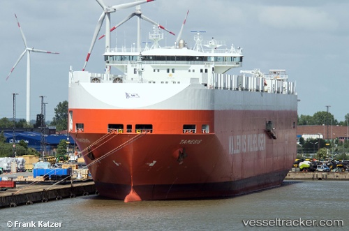
Vessel Tamesis IMO: 9191307, MMSI: 257565000 Vehicles Carrier
UTC, 36.31333, 146.10167, course: -1, speed: 18
UTC, 36.31167, 147.06332, course: -1, speed: 19
2026-02-14 23:55:56 UTC, 36.31050, 147.84248, course: 90, speed: 17.7
Live AIS position:
UTC. 217 nm E of Santa Venera),
updated 2026-02-14 23:55:56 UTC.
Find the position of the vessel Tamesis on the map. The latter are known coordinates and path.
marine traffic ship tracker show on live map
The current position of vessel Tamesis is 36.31050 lat / 147.84248 lng. Updated: 2026-02-14 23:55:56 UTCCurrently sailing under the flag of Norway
Tamesis built in 2000 year
Deadweight:
39516 tDetails:
Last coordinates of the vessel:
UTC, 36.31333, 145.73833, course: -1, speed: 18UTC, 36.31333, 146.10167, course: -1, speed: 18
UTC, 36.31167, 147.06332, course: -1, speed: 19
2026-02-14 23:55:56 UTC, 36.31050, 147.84248, course: 90, speed: 17.7