 vesseltracker.com
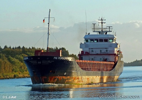
Vessel Fri Porsgrunn IMO: 9196199, MMSI: 209211000 Multi Purpose Carrier
UTC, 40.72667, -10.10833, course: -1, speed: 6
UTC, 40.51628, -10.17265, course: 196, speed: 7.3
2026-02-06 15:53:24 UTC, 40.23577, -10.06668, course: 150, speed: 8.4
Live AIS position:
UTC. 55 nm W of Figuera Da Foz),
updated 2026-02-06 15:53:24 UTC.
Find the position of the vessel Fri Porsgrunn on the map. The latter are known coordinates and path.
marine traffic ship tracker show on live map
The current position of vessel Fri Porsgrunn is 40.23577 lat / -10.06668 lng. Updated: 2026-02-06 15:53:24 UTCCurrently sailing under the flag of Cyprus
Fri Porsgrunn built in 2000 year
Deadweight:
3792 tDetails:
Last coordinates of the vessel:
UTC, 40.85413, -10.05474, course: 202, speed: 6.8UTC, 40.72667, -10.10833, course: -1, speed: 6
UTC, 40.51628, -10.17265, course: 196, speed: 7.3
2026-02-06 15:53:24 UTC, 40.23577, -10.06668, course: 150, speed: 8.4