 vesseltracker.com
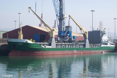
Vessel CYGNUS IMO: 9197428, MMSI: 255802970 General Cargo
UTC, 18.41278, -69.35054, course: 133, speed: 0.3
UTC, 18.41243, -69.35077, course: 105, speed: 0.1
2026-02-24 05:42:55 UTC, 18.41190, -69.35073, course: 80, speed: 0.2
Live AIS position:
UTC. Near San Pedro De Macoris),
updated 2026-02-24 05:42:55 UTC.
Find the position of the vessel CYGNUS on the map. The latter are known coordinates and path.
marine traffic ship tracker show on live map
The current position of vessel CYGNUS is 18.41190 lat / -69.35073 lng. Updated: 2026-02-24 05:42:55 UTCCurrently sailing under the flag of Portugal
Details:
Last coordinates of the vessel:
UTC, 18.41253, -69.35069, course: 97, speed: 0.4UTC, 18.41278, -69.35054, course: 133, speed: 0.3
UTC, 18.41243, -69.35077, course: 105, speed: 0.1
2026-02-24 05:42:55 UTC, 18.41190, -69.35073, course: 80, speed: 0.2