 vesseltracker.com
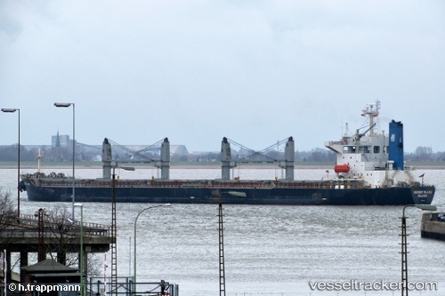
Vessel ATA M IMO: 9197662, MMSI: 370734000 Bulk Carrier
UTC, 38.96688, 121.81598, course: 223, speed: 0
UTC, 38.96667, 121.81500, course: -1, speed: 0
2026-02-27 11:26:17 UTC, 38.96686, 121.81596, course: 223, speed: 0
Live AIS position:
UTC. Near Dalian),
updated 2026-02-27 11:26:17 UTC.
Find the position of the vessel ATA M on the map. The latter are known coordinates and path.
marine traffic ship tracker show on live map
The current position of vessel ATA M is 38.96686 lat / 121.81596 lng. Updated: 2026-02-27 11:26:17 UTCCurrently sailing under the flag of Panama
ATA M built in 2001 year
Deadweight:
52549 tDetails:
Last coordinates of the vessel:
UTC, 38.96667, 121.81500, course: -1, speed: 0UTC, 38.96688, 121.81598, course: 223, speed: 0
UTC, 38.96667, 121.81500, course: -1, speed: 0
2026-02-27 11:26:17 UTC, 38.96686, 121.81596, course: 223, speed: 0