 vesseltracker.com
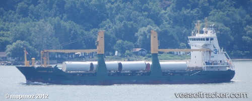
Vessel INDUSTRIAL AIM IMO: 9204934, MMSI: 304010983 General Cargo
UTC, 16.91097, -73.46152, course: 117, speed: 12.6
UTC, 16.75412, -73.12716, course: 116, speed: 12.6
2026-01-31 17:24:45 UTC, 16.52517, -72.63729, course: 114, speed: 12.6
Live AIS position:
UTC. 102 nm S of Jacmel),
updated 2026-01-31 17:24:45 UTC.
Find the position of the vessel INDUSTRIAL AIM on the map. The latter are known coordinates and path.
marine traffic ship tracker show on live map
The current position of vessel INDUSTRIAL AIM is 16.52517 lat / -72.63729 lng. Updated: 2026-01-31 17:24:45 UTCCurrently sailing under the flag of Antigua Barbuda
Details:
Last coordinates of the vessel:
UTC, 17.08769, -73.83657, course: 124, speed: 12.4UTC, 16.91097, -73.46152, course: 117, speed: 12.6
UTC, 16.75412, -73.12716, course: 116, speed: 12.6
2026-01-31 17:24:45 UTC, 16.52517, -72.63729, course: 114, speed: 12.6