 vesseltracker.com
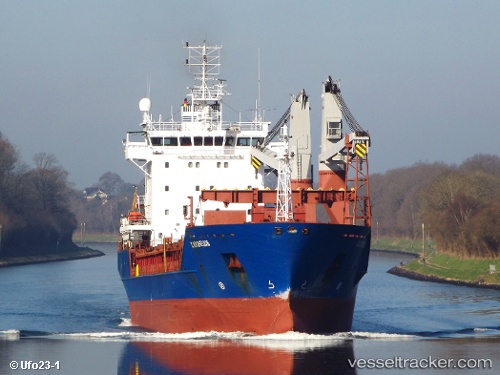
Vessel S.kuznetsov IMO: 9210359, MMSI: 273336180 Multi Purpose Carrier
UTC, 31.20703, 29.71267, course: 273, speed: 0.2
UTC, 31.20630, 29.71263, course: -1, speed: 0.1
2026-02-25 14:22:06 UTC, 31.18800, 29.75455, course: 324, speed: 0.1
Live AIS position:
UTC. Near EL DEKHEILA),
updated 2026-02-25 14:22:06 UTC.
Find the position of the vessel S.kuznetsov on the map. The latter are known coordinates and path.
marine traffic ship tracker show on live map
The current position of vessel S.kuznetsov is 31.18800 lat / 29.75455 lng. Updated: 2026-02-25 14:22:06 UTCCurrently sailing under the flag of Russia
S.kuznetsov built in 2001 year
Deadweight:
7625 tDetails:
Last coordinates of the vessel:
UTC, 31.20741, 29.71248, course: 239, speed: 0.2UTC, 31.20703, 29.71267, course: 273, speed: 0.2
UTC, 31.20630, 29.71263, course: -1, speed: 0.1
2026-02-25 14:22:06 UTC, 31.18800, 29.75455, course: 324, speed: 0.1