 vesseltracker.com
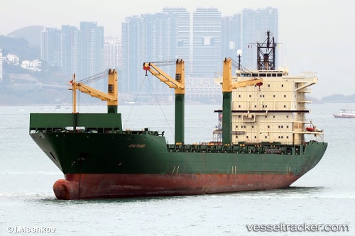
Vessel MERATUS JAYAGIRI IMO: 9213117, MMSI: 352002649 Container Ship
UTC, 26.45178, 119.70840, course: 306, speed: 0
UTC, 26.45180, 119.70844, course: 306, speed: 0
2026-02-26 15:24:47 UTC, 26.45167, 119.70833, course: -1, speed: 0
Live AIS position:
UTC. Near Luoyuanwan),
updated 2026-02-26 15:24:47 UTC.
Find the position of the vessel MERATUS JAYAGIRI on the map. The latter are known coordinates and path.
marine traffic ship tracker show on live map
The current position of vessel MERATUS JAYAGIRI is 26.45167 lat / 119.70833 lng. Updated: 2026-02-26 15:24:47 UTCCurrently sailing under the flag of Panama
Details:
Last coordinates of the vessel:
UTC, 26.45189, 119.70839, course: 306, speed: 0UTC, 26.45178, 119.70840, course: 306, speed: 0
UTC, 26.45180, 119.70844, course: 306, speed: 0
2026-02-26 15:24:47 UTC, 26.45167, 119.70833, course: -1, speed: 0