.
vessel ALBEDO IMO: 9213313, Crude Oil Tanker vesseltracker.com
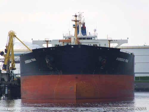
Vessel ALBEDO IMO: 9213313, MMSI: 626347000 Crude Oil Tanker

callsign: T8A3769
size: 250x44

Live AIS position: UTC. 399 nm SE of Luque), updated 2026-01-09 01:31:19 UTC.

Find the position of the vessel ALBEDO on the map. The latter are known coordinates and path.

marine traffic ship tracker show on live map

The current position of vessel ALBEDO is 19.58000 lat / -53.84967 lng. Updated: 2026-01-09 01:31:19 UTC

Currently sailing under the flag of Gabon

ALBEDO built in 2001 year

Deadweight:
112118 t

Details:


Last coordinates of the vessel:
2026-01-09 01:31:19 UTC, 19.58000, -53.84967, course: 262, speed: 0.8


Most frequent ports a vessels calls at ALBEDO (626347000):

CHANGXINDAO, traffic: 8
Willemstad, traffic: 2
PENGERANG, traffic: 1
Algeciras, traffic: 1
BUKOM ISLAND, traffic: 1
Bur Ibrahim, traffic: 1
PULAU SAMBU, traffic: 1
Lome, traffic: 1
BATU AMPAR, traffic: 1
Port Louis, traffic: 1
TANAH MERAH, traffic: 1
Port Said, traffic: 1
Sambu, traffic: 1
Singapore, traffic: 1

Link to the map:


Find another ship

ALBEDO (626347000) last ports (portcalls and passsages)

CHANGXINDAO | 2025-06-13 12:49:54
CHANGXINDAO | 2025-06-09 12:22:09
CHANGXINDAO | 2025-06-05 12:00:44
CHANGXINDAO | 2025-06-01 11:49:40
CHANGXINDAO | 2025-05-28 10:49:17
CHANGXINDAO | 2025-05-24 09:53:56
CHANGXINDAO | 2025-05-20 08:36:06
CHANGXINDAO | 2025-05-16 07:49:12
JINHAI HEAVY INDUSTR | 2025-05-06 23:50:28
PENGERANG | 2025-03-05 19:49:59
TANAH MERAH | 2025-03-05 18:49:29
PULAU SAMBU | 2025-03-05 17:35:22
BUKOM ISLAND | 2025-03-05 16:44:16
Port Louis | 2025-02-13 08:06:14
Lome | 2025-01-07 15:34:11
Willemstad | 2024-12-21 19:20:53
Willemstad | 2024-11-21 19:08:18
Algeciras | 2024-10-29 17:04:27
Port Said | 2024-10-19 13:58:26
Bur Ibrahim | 2024-10-19 04:11:30