 vesseltracker.com
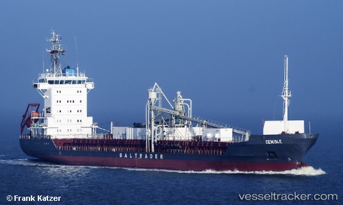
Vessel Cemisle IMO: 9213911, MMSI: 305399000 Cement Carrier
UTC, 51.27083, 3.84683, course: 302, speed: 0
UTC, 51.27083, 3.84683, course: 302, speed: 0
2026-02-05 15:23:47 UTC, 51.27083, 3.84683, course: 302, speed: 0
Live AIS position:
UTC. Near SLUISKIL),
updated 2026-02-05 15:23:47 UTC.
Find the position of the vessel Cemisle on the map. The latter are known coordinates and path.
marine traffic ship tracker show on live map
The current position of vessel Cemisle is 51.27083 lat / 3.84683 lng. Updated: 2026-02-05 15:23:47 UTCCurrently sailing under the flag of Antigua Barbuda
Cemisle built in 2000 year
Deadweight:
5183 tDetails:
Last coordinates of the vessel:
UTC, 51.27083, 3.84683, course: 302, speed: 0UTC, 51.27083, 3.84683, course: 302, speed: 0
UTC, 51.27083, 3.84683, course: 302, speed: 0
2026-02-05 15:23:47 UTC, 51.27083, 3.84683, course: 302, speed: 0