 vesseltracker.com
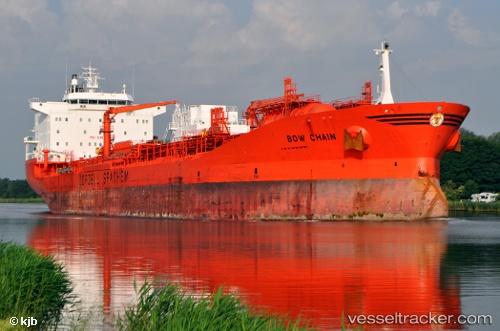
Vessel BOW CHAIN IMO: 9214317, MMSI: 538011822 Oil/Chemical Tanker
UTC, -32.76667, -60.71667, course: -1, speed: 0
UTC, -32.76667, -60.71667, course: -1, speed: 0
2026-02-25 16:10:51 UTC, -32.76667, -60.71667, course: -1, speed: 0
Live AIS position:
UTC. Near Fray Luis A. Beltrán),
updated 2026-02-25 16:10:51 UTC.
Find the position of the vessel BOW CHAIN on the map. The latter are known coordinates and path.
marine traffic ship tracker show on live map
The current position of vessel BOW CHAIN is -32.76667 lat / -60.71667 lng. Updated: 2026-02-25 16:10:51 UTCCurrently sailing under the flag of Marshall Islands
Details:
Last coordinates of the vessel:
UTC, -32.76673, -60.71656, course: -1, speed: 0UTC, -32.76667, -60.71667, course: -1, speed: 0
UTC, -32.76667, -60.71667, course: -1, speed: 0
2026-02-25 16:10:51 UTC, -32.76667, -60.71667, course: -1, speed: 0