 vesseltracker.com
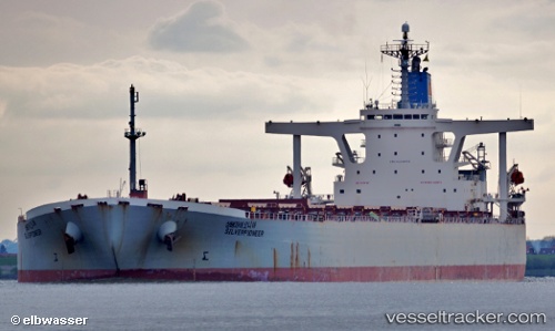
Vessel GUNSAN IMO: 9218832, MMSI: 341404002 Bulk Carrier
UTC, -7.06875, -3.55869, course: 143, speed: 9.2
UTC, -7.27778, -3.40744, course: 143, speed: 9.3
2026-03-06 01:14:26 UTC, -7.51665, -3.23500, course: 142, speed: 9.5
Live Vessel GUNSAN Analytics (details, animations, etc.)
Live AIS position: UTC. Open sea (no nearby ports in database)), updated 2026-03-06 01:14:26 UTC.Find the position of the vessel GUNSAN on the map. The latter are known coordinates and path.
marine traffic ship tracker show on live map
The current position of vessel GUNSAN is -7.51665 lat / -3.23500 lng. Updated: 2026-03-06 01:14:26 UTCCurrently sailing under the flag of Saint Kitts and Nevis
Details:
Last coordinates of the vessel:
UTC, -6.87742, -3.69771, course: 142, speed: 9.2UTC, -7.06875, -3.55869, course: 143, speed: 9.2
UTC, -7.27778, -3.40744, course: 143, speed: 9.3
2026-03-06 01:14:26 UTC, -7.51665, -3.23500, course: 142, speed: 9.5