 vesseltracker.com
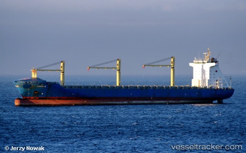
Vessel LODUR IMO: 9219381, MMSI: 255916596 Container Ship
UTC, 42.06269, 3.51477, course: 225, speed: 12.8
UTC, 41.74833, 3.10167, course: -1, speed: 13
2026-02-27 13:58:43 UTC, 41.53134, 2.77845, course: 228, speed: 12.7
Live AIS position:
UTC. Near Macanet de la Selva),
updated 2026-02-27 13:58:43 UTC.
Find the position of the vessel LODUR on the map. The latter are known coordinates and path.
marine traffic ship tracker show on live map
The current position of vessel LODUR is 41.53134 lat / 2.77845 lng. Updated: 2026-02-27 13:58:43 UTCCurrently sailing under the flag of Portugal
Details:
Last coordinates of the vessel:
UTC, 42.54500, 4.14500, course: -1, speed: 13UTC, 42.06269, 3.51477, course: 225, speed: 12.8
UTC, 41.74833, 3.10167, course: -1, speed: 13
2026-02-27 13:58:43 UTC, 41.53134, 2.77845, course: 228, speed: 12.7