 vesseltracker.com
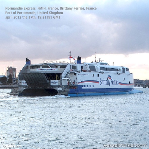
Vessel '311001050' IMO: 9221358, MMSI: 311001050
UTC, 48.64167, -2.02667, course: -1, speed: 0
UTC, 48.66778, -2.03614, course: 10, speed: 5.8
2026-02-07 13:48:47 UTC, 48.81193, -2.14064, course: 83, speed: 2.1
Live AIS position:
UTC. Near Maitresse Island),
updated 2026-02-07 13:48:47 UTC.
Find the position of the vessel '311001050' on the map. The latter are known coordinates and path.
marine traffic ship tracker show on live map
The current position of vessel '311001050' is 48.81193 lat / -2.14064 lng. Updated: 2026-02-07 13:48:47 UTCDetails:
Last coordinates of the vessel:
UTC, 48.64167, -2.02667, course: -1, speed: 0UTC, 48.64167, -2.02667, course: -1, speed: 0
UTC, 48.66778, -2.03614, course: 10, speed: 5.8
2026-02-07 13:48:47 UTC, 48.81193, -2.14064, course: 83, speed: 2.1