 vesseltracker.com
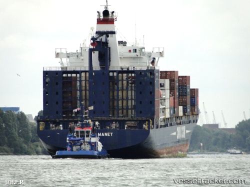
Vessel MANET IMO: 9224958, MMSI: 636019770 Container Ship
UTC, 22.30844, 114.08176, course: 159, speed: 0.6
UTC, 22.35561, 113.92728, course: 310, speed: 11.7
2026-03-20 15:46:43 UTC, 22.44887, 113.88553, course: 175, speed: 0
Live Vessel MANET Analytics (details, animations, etc.)
Live AIS position: UTC. Near Mawan Pt), updated 2026-03-20 15:46:43 UTC.Find the position of the vessel MANET on the map. The latter are known coordinates and path.
marine traffic ship tracker show on live map
The current position of vessel MANET is 22.44887 lat / 113.88553 lng. Updated: 2026-03-20 15:46:43 UTCCurrently sailing under the flag of Liberia
MANET built in 2001 year
Deadweight:
30442 tDetails:
Last coordinates of the vessel:
UTC, 22.32725, 114.13297, course: 72, speed: 0UTC, 22.30844, 114.08176, course: 159, speed: 0.6
UTC, 22.35561, 113.92728, course: 310, speed: 11.7
2026-03-20 15:46:43 UTC, 22.44887, 113.88553, course: 175, speed: 0