 vesseltracker.com
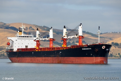
Vessel Gulluk IMO: 9228100, MMSI: 271044383 Bulk Carrier
UTC, 39.09933, 0.79514, course: 132, speed: 13.6
UTC, 39.07573, 0.82726, course: 132, speed: 13.4
2026-03-06 05:59:35 UTC, 38.48114, 1.37660, course: 131, speed: 12.4
Live Vessel Gulluk Analytics (details, animations, etc.)
Live AIS position: UTC. 14 nm SW of Formentera Island), updated 2026-03-06 05:59:35 UTC.Find the position of the vessel Gulluk on the map. The latter are known coordinates and path.
marine traffic ship tracker show on live map
The current position of vessel Gulluk is 38.48114 lat / 1.37660 lng. Updated: 2026-03-06 05:59:35 UTCCurrently sailing under the flag of Turkey
Gulluk built in 2002 year
Deadweight:
50992 tDetails:
Last coordinates of the vessel:
UTC, 39.43519, 0.47673, course: 148, speed: 12.8UTC, 39.09933, 0.79514, course: 132, speed: 13.6
UTC, 39.07573, 0.82726, course: 132, speed: 13.4
2026-03-06 05:59:35 UTC, 38.48114, 1.37660, course: 131, speed: 12.4