 vesseltracker.com
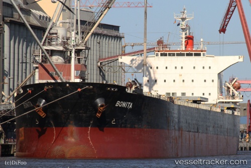
Vessel Bonita IMO: 9231286, MMSI: 636091840 Bulk Carrier
Live Vessel Bonita Analytics (details, animations, etc.)
Live AIS position: UTC. Open sea, approx. 426 nm off the nearest listed port), updated 2025-11-02 22:46:51 UTC.Find the position of the vessel Bonita on the map. The latter are known coordinates and path.
marine traffic ship tracker show on live map
The current position of vessel Bonita is 79.93662 lat / -149.38495 lng. Updated: 2025-11-02 22:46:51 UTCCurrently sailing under the flag of Liberia
Bonita built in 2001 year
Deadweight:
76623 tDetails:
Last coordinates of the vessel:
2025-11-02 22:46:51 UTC, 79.93662, -149.38495, course: 235, speed: 45.5