 vesseltracker.com
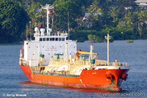
Vessel OCEAN GAS IMO: 9236901, MMSI: 441355000 LPG Tanker
UTC, 36.34302, 125.87001, course: 10, speed: 11.7
UTC, 36.60620, 125.94337, course: -1, speed: 11.1
2026-02-27 05:39:14 UTC, 36.87878, 126.15720, course: -1, speed: 9.1
Live AIS position:
UTC. Near TAEAN-GUN),
updated 2026-02-27 05:39:14 UTC.
Find the position of the vessel OCEAN GAS on the map. The latter are known coordinates and path.
marine traffic ship tracker show on live map
The current position of vessel OCEAN GAS is 36.87878 lat / 126.15720 lng. Updated: 2026-02-27 05:39:14 UTCCurrently sailing under the flag of Korea (Republic of)
OCEAN GAS built in 2001 year
Deadweight:
3409 tDetails:
Last coordinates of the vessel:
UTC, 35.90818, 125.75342, course: -1, speed: 11.8UTC, 36.34302, 125.87001, course: 10, speed: 11.7
UTC, 36.60620, 125.94337, course: -1, speed: 11.1
2026-02-27 05:39:14 UTC, 36.87878, 126.15720, course: -1, speed: 9.1