 vesseltracker.com
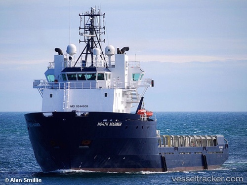
Vessel SAR MARINER IMO: 9244609, MMSI: 259243000 Offshore Supply Ship
UTC, 57.26500, 0.78833, course: -1, speed: 1
UTC, 57.24176, 0.76064, course: -1, speed: 1
2026-03-04 18:53:03 UTC, 57.29406, 0.79604, course: -1, speed: 1.7
Live Vessel SAR MARINER Analytics (details, animations, etc.)
Live AIS position: UTC. Near Anasuria), updated 2026-03-04 18:53:03 UTC.Find the position of the vessel SAR MARINER on the map. The latter are known coordinates and path.
marine traffic ship tracker show on live map
The current position of vessel SAR MARINER is 57.29406 lat / 0.79604 lng. Updated: 2026-03-04 18:53:03 UTCCurrently sailing under the flag of Norway
Details:
Last coordinates of the vessel:
UTC, 57.25667, 0.80500, course: -1, speed: 0UTC, 57.26500, 0.78833, course: -1, speed: 1
UTC, 57.24176, 0.76064, course: -1, speed: 1
2026-03-04 18:53:03 UTC, 57.29406, 0.79604, course: -1, speed: 1.7