 vesseltracker.com
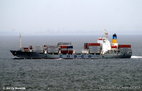
Vessel Cosco Kiku IMO: 9247871, MMSI: 354358000 Container Ship
UTC, 34.31080, 138.46906, course: 247, speed: 15.7
UTC, 34.07352, 137.83450, course: 247, speed: 14.9
2026-02-07 05:35:59 UTC, 33.88974, 137.32050, course: 247, speed: 15.2
Live AIS position:
UTC. 36 nm SE of Shima, Mie),
updated 2026-02-07 05:35:59 UTC.
Find the position of the vessel Cosco Kiku on the map. The latter are known coordinates and path.
marine traffic ship tracker show on live map
The current position of vessel Cosco Kiku is 33.88974 lat / 137.32050 lng. Updated: 2026-02-07 05:35:59 UTCCurrently sailing under the flag of Panama
Cosco Kiku built in 2002 year
Deadweight:
9294 tDetails:
Last coordinates of the vessel:
UTC, 34.52399, 139.00665, course: 213, speed: 16.1UTC, 34.31080, 138.46906, course: 247, speed: 15.7
UTC, 34.07352, 137.83450, course: 247, speed: 14.9
2026-02-07 05:35:59 UTC, 33.88974, 137.32050, course: 247, speed: 15.2